Skip to content
Artwork for Spatial Stack with Matt Forrest
BusinessCareersTechnology

Spatial Stack with Matt Forrest

Matt Forrest

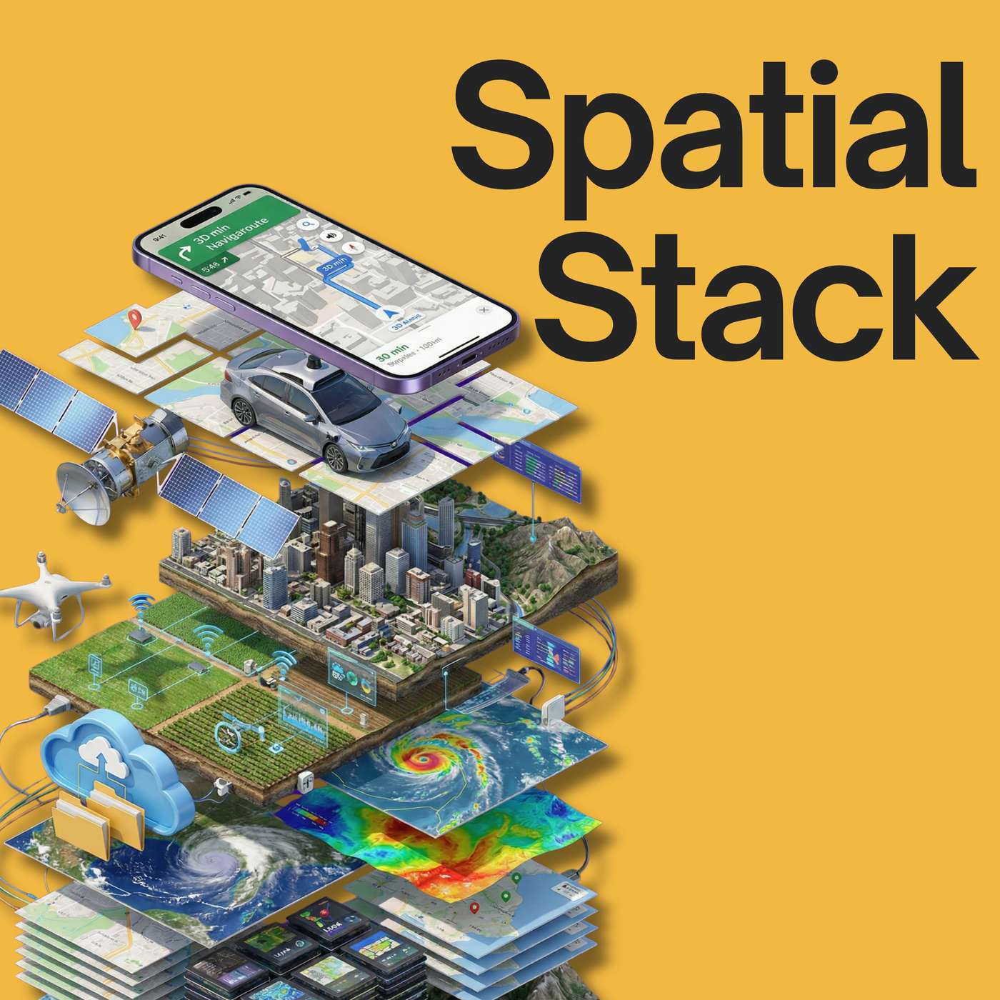
Welcome to The Spatial Stack, where modern geospatial technology takes center stage. Our episodes feature interviews with leading experts, insightful discussions on the integration of AI and big data in spatial tech, and case studies on groundbreaking projects worldwide. Tune in to stay ahead in the rapidly evolving world of geospatial technology!

Play
  • 20 episodes
  • Avg 38 min
  • English
  • #53
    September 8 · 47 min

    Thinking Spatially for a Living: Chris Tucker on 175 Years of the American Geographical Society

    In this episode of the Spatial Stack, Matt sits down with Dr. Chris Tucker, chairman of the American Geographical Society, in the year the AGS turns 175. Chris makes the case that spatial thinking is foundational literacy, on the level of language or math, and that the 4.5 million people who have taken AP Human Geography are already practicing it every day in jobs that never mention geography. He shares how a single question from a CIA veteran, about why we cannot draw a bounding box on a map and pull in everything known about that place at that moment, set the direction for almost thirty years of his career. The conversation also covers what has changed about getting into this work. The advanced degree, the expensive workstation, and the expensive software used to be the price of entry. Free tools and YouTube replaced all three. Chris then takes on a challenge: name five careers that do not sound geographic but where spatial skills give you a real edge. Surveying, the CAD and built environment world, aviation, marine navigation, and conservation all make the list, along with a case for why geography works as both a horizontal and a vertical. We also get into the AGS itself, from the Fliers' and Explorers' Globe signed by Amelia Earhart, Sir Edmund Hillary, and Neil Armstrong, to the geographers at 156th and Broadway who worked on the inquiry behind the Treaty of Versailles. If you have ever struggled to explain what you actually do for a living, this conversation gives you better language for it. Connect with Chris Tucker and the AGS: LinkedIn: https://www.linkedin.com/in/christopher-tucker-5595689/ American Geographical Society: https://www.americangeo.org Email: tucker@americangeo.org LEARN MORE AGS 175th anniversary campaign: https://www.americangeo.org The Fliers' and Explorers' Globe: https://www.americangeo.org/globe Geography 2050 (Africa: Shaping the Future): https://www.geography2050.org Teen Maptivist: https://teenmaptivists.org CHAPTERS: 00:00:00 – Welcome and Chris Tucker's Background 00:01:21 – 4.5 Million AP Human Geography Students 00:04:48 – Spatial Thinking as Foundational Literacy 00:09:08 – 175 Years of the American Geographical Society 00:12:03 – The Fliers' and Explorers' Globe 00:15:05 – The AGS and the Treaty of Versailles 00:18:02 – The 175th Anniversary Campaign 00:21:49 – How Matt and Chris Found Geography 00:24:59 – Free Tools and Getting Back Into the Work 00:27:07 – Advocating for Geography in Schools 00:30:55 – Geography as Horizontal and Vertical 00:35:01 – Five Careers Where Spatial Gives You an Edge 00:40:34 – Getting Involved with AGS and Geography 2050 --- 📊 FREE: The Modern GIS Skill Map The 5 skills that actually matter in modern GIS (and what you can stop learning). Based on a survey of 1,400+ geospatial professionals. ➡ Get the free training + PDF guide: https://forrest.nyc/go/training/ 📰 Daily modern GIS insights: https://forrest.nyc CONNECT WITH ME 📸 Instagram: https://www.instagram.com/matt_forrest/ 💼 LinkedIn: https://www.linkedin.com/in/mbforr/ 📧 Newsletter: https://forrest.nyc 🌐 Website: https://forrest.nyc

    • Chapters
  • #52
    August 26 · 38 min

    Mapping the Invisible: Soil Fungi, Satellites, and the Largest Network on Earth with Justin Stewart

    What does it take to map something you have never seen? In this episode, Matt Forrest sits down with Justin Stewart, quantitative ecologist at SPUN, the Society for the Protection of Underground Networks, to unpack how his team built the first global map of arbuscular mycorrhizal fungi, the soil organisms living in symbiosis with most plants on Earth. Justin walks through the full pipeline, from robotic microscopy of threads two and a half microns wide up to a planetary prediction at one square kilometer resolution. The team assembled 16,000 soil samples from more than 300 studies across 11 languages, trained a random forest on 34 satellite-derived layers in Google Earth Engine, and summed the result: roughly 110 quadrillion kilometers of fungal thread, about 300 megatons of carbon, six times the biomass of every human alive. The findings were not what anyone expected. The densest networks are under grasslands, not forests. Croplands run about 50 percent sparser. And 90 percent of the biodiversity hotspots for these fungi sit outside any protected area. In this episode, we cover: - Why mapping a symbiosis is harder than mapping an organism - Robotic imaging in the Amolf biophysics lab, and tracking half a million nodes at once - Building a global database from literature in 11 languages - Random forest niche modeling and uncertainty analysis in Google Earth Engine - The effective radius algorithm that turns network length into biomass - Why grasslands, flooded wetlands, and the Tibetan plateau light up on the map - Tilling, fertilizer, and how a 450 million year old symbiosis gets broken - Rights of nature, eDNA, and why predictive maps are not yet admissible evidence LINKS: Justin Stewart SPUN profile: https://www.spun.earth/team-members/justin-stewart LinkedIn: https://www.linkedin.com/in/justin-stewart-70512645/ Google Scholar: https://scholar.google.com/citations?hl=en&user=1aqTJIUAAAAJ SPUN Website: https://www.spun.earth Underground Atlas: https://a-hidden-infrastructure.spun.earth/story/a-hidden-infrastructure LEARN MORE The paper: Science, June 11, 2026. DOI 10.1126/science.adu4373 Mycorrhizal Biodiversity Map: https://a-hidden-infrastructure.spun.earth/story/a-hidden-infrastructure CHAPTERS: 00:00:00 – The largest living network on Earth 00:02:15 – Welcome and intro 00:03:38 – What the map shows: a partnership, not an organism 00:05:48 – Robots, petri dishes, and carbon moving at 400 kilometers an hour 00:07:47 – The question that started it: how much is out there? 00:09:25 – 110 quadrillion kilometers and six times human biomass 00:11:15 – What a quantitative ecologist actually does 00:13:53 – Trade, lipids, and 30 percent of a plant's nitrogen 00:16:31 – What people get wrong about soil 00:18:27 – The pipeline: 34 satellite layers, random forest, Earth Engine 00:21:02 – From length to weight: effective radius and the robot named Prince 00:25:41 – Croplands and a broken 450 million year symbiosis 00:31:40 – Rights of nature and getting predictions accepted as evidence 00:37:10 – Where to find SPUN and Justin 📊 FREE: The Modern GIS Skill Map The 5 skills that actually matter in modern GIS (and what you can stop learning). Based on a survey of 1,400+ geospatial professionals. ➡ Get the free training + PDF guide: https://forrest.nyc/go/training/ 📰 Daily modern GIS insights: https://forrest.nyc CONNECT WITH ME 📸 Instagram: https://www.instagram.com/matt_forrest/ 💼 LinkedIn: https://www.linkedin.com/in/mbforr/ 📧 Newsletter: https://forrest.nyc 🌐 Website: https://forrest.nyc

  • #51
    July 16 · 42 min

    Beyond the Blue Dot: AI & LLM Navigation with Zephr's Sean Gorman and Pramukta Rao

    What does it actually take for an AI to navigate you through the real world, without a screen and without a camera running the whole time? In this episode of the Spatial Stack, Matt Forrest sits down with Sean Gorman and Pramukta Rao, the co-founders of Zephr, to unpack how they ground large language models in location. Sean and Pramukta spent twenty years building startups together, from GeoIQ to Snap's visual positioning work, and at Zephr they walked away from the camera and went back to the sensors already in your phone. They get into why the blue dot on a map breaks down the moment you stop looking at a screen, why language models are bad at spatial reasoning like left, right, and across the street, and how they fix it by doing the geometry first and handing the model clean language. Instead of training ever-bigger foundation models, they push a small model and well-structured data down to the edge so the conversation stays fast. In this episode, we cover: - Why they left visual positioning and AR cameras behind after Snap - Cooperative positioning: getting survey-grade accuracy out of commodity phones - GNSS and the urban canyon problem (3 meters to 50 meters and back) - Beyond the blue dot: building a first-person, egocentric experience - Why LLMs struggle with geometry, and what context engineering solves - Small models at the edge vs giant foundation models - Overture Maps, GERS IDs, and conflating POIs with imagery to "agree on reality" - The grounding service: MCP, REST, and Opus or Gemma on device - Conversations about place as a new geospatial primitive Whether you build with spatial data, work on AI navigation, or just want to see where location and LLMs are heading, this conversation is your field guide. Connect with Zephr: Website: https://zephr.xyz Sean Gorman (LinkedIn): https://www.linkedin.com/in/sean-gorman-93a79 Pramukta Rao (LinkedIn): https://www.linkedin.com/in/pramukta/ Zephr (LinkedIn): https://www.linkedin.com/company/zephr-xyz 00:00:00 – Intro and twenty years of startups together 00:04:05 – Why they walked away from cameras and AR at Snap 00:04:54 – Commodity sensors and cooperative positioning 00:07:15 – GNSS 101 and the urban canyon problem 00:10:56 – Beyond the blue dot: an egocentric experience 00:13:37 – Why LLMs are bad at left, right, and across the street 00:18:19 – Context engineering and the retrieval problem 00:22:03 – Small models at the edge vs giant foundation models 00:30:09 – Collective memory: OpenStreetMap, Mapillary, Overture 00:32:08 – Conflating POIs with imagery to agree on reality 00:35:36 – The grounding service: MCP, REST, Opus or Gemma on device 00:38:37 – What's next: conversations as a new geospatial primitive 00:42:22 – Where to find Zephr 📊 FREE: The Modern GIS Skill Map The 5 skills that actually matter in modern GIS (and what you can stop learning). Based on a survey of 1,400+ geospatial professionals. ➡ Get the free training + PDF guide: https://forrest.nyc/go/training/ 🚀 Join The Spatial Lab: Stop guessing at your career path. Get direct mentorship, advanced training, and a roadmap to these high-value roles inside The Spatial Lab. 👉 https://forrest.nyc/spatial-lab/ 📰 Daily modern GIS insights: https://forrest.nyc CONNECT WITH ME 📸 Instagram: https://www.instagram.com/matt_forrest/ 💼 LinkedIn: https://www.linkedin.com/in/mbforr/ 📧 Newsletter: https://forrest.nyc 🌐 Website: https://forrest.nyc

  • July 14 · 16 min

    Why the GIS Title Is Shrinking but Spatial Work Is Growing

    In this episode of the Spatial Stack, Matt sits down solo to work through a fight that broke out across Reddit and LinkedIn last week: is GIS dying, or is it just changing its name? It started with a GIS manager who argued the field is alive, pointing to a friend who landed a $200,000 job building autonomous systems, a role where GIS never appeared in the title or the description. The comments pushed back. If the keyword for our whole profession barely returns jobs anymore, is the field really growing? Matt's answer is that both sides are right. The work of spatial is expanding into data engineering, software, and product roles. The GIS title is contracting at the same time. It's one trend seen from two directions, the same way geology departments quietly became geoscience without the work ever changing. He makes the case that the title was never the skill. Spatial intuition is, and it's the thing that transfers into higher-paying roles that don't carry the GIS label. Then he closes with a challenge: describe who you are and what you do without using the words GIS, spatial, or geospatial. Whether you're job hunting, stuck in the technician trap, or an employer who wants this skill set but doesn't know what to call it, this conversation is about how we position the work going forward. --- 📊 FREE: The Modern GIS Skill Map The 5 skills that actually matter in modern GIS (and what you can stop learning). Based on a survey of 1,400+ geospatial professionals. ➡ Get the free training + PDF guide: https://forrest.nyc/go/training/ CHAPTERS: 00:00:00 – The Reddit post that started it 00:01:00 – Two views: the work is growing vs. the title is shrinking 00:02:34 – Why "stay positive" doesn't pay the rent 00:03:33 – Spatial is special: what actually transfers 00:04:53 – The geology-to-geoscience analogy 00:05:54 – The title of GIS was never the skill 00:07:09 – The technician trap and where the salaries moved 00:08:18 – Listener comments: spatial judgment, the map as interface 00:10:32 – What to do now: SQL, Python, and cloud-native beyond the toolbox 00:11:51 – Building a portfolio on LinkedIn 00:13:22 – The Spatial Intuition Challenge 00:15:32 – Put your face on it: make it a video CONNECT WITH ME 📸 Instagram: https://www.instagram.com/matt_forrest/ 💼 LinkedIn: https://www.linkedin.com/in/mbforr/ 📧 Newsletter: https://forrest.nyc 🌐 Website: https://forrest.nyc

  • #50
    June 17 · 49 min

    AI, Embeddings, and the Future of Location Data with Dataplor's Ryan Urabe

    What does it actually take to make AI useful on location data? In this episode, Matt Forrest sits down with Ryan Urabe, co-founder and CTO of Dataplor, to unpack how AI, embeddings, and agents are changing the way we work with points of interest and places data. Ryan explains why general-purpose models already understand spatial concepts but still struggle to execute them, and why the real unlock is the harness around the model, not a geospatial-specific model. He walks through Dataplor's data-quality philosophy, the category problem (why "supermarket" and "grocery store" have zero string similarity but near-zero conceptual distance), and how embeddings let them measure conceptual distance across 10^9 places and even across languages. Whether you build with spatial data, lead a data team adopting AI, or you are trying to figure out what embeddings actually do, this conversation maps out what is working today and what is still forming. In this episode, we cover: - Why AI is an accelerant for data quality, not a replacement for it - Treating AI like a capable employee on their first day - Where general models fall short on spatial problems - DuckDB as the Swiss Army knife for orchestrating spatial data - The category problem and conceptual vs. semantic distance - How embeddings map 7-Eleven in Tokyo and Tennessee to the same concept - A vision for agentic AI built natively for geospatial - The "end of the scarcity of intelligence" framing for where this is all heading Connect with Ryan: LinkedIn: https://www.linkedin.com/in/rurabe/ Website: https://www.dataplor.com Email: ryan@dataplor.com LEARN MORE Dataplor's agentic SaaS product is launching this summer. To start your complimentary trial, contact: freetrial@dataplor.com 📊 FREE: The Modern GIS Skill Map The 5 skills that actually matter in modern GIS (and what you can stop learning). Based on a survey of 1,400+ geospatial professionals. ➡ Get the free training + PDF guide: https://forrest.nyc/go/training/ 00:00:00 – Cold open 00:01:01 – Welcome and Ryan's background 00:03:44 – Why AI still struggles with location 00:05:13 – Bringing Dataplor's data into AI, product and team 00:08:36 – How technical teams are adopting AI 00:10:10 – Treating AI like a capable new employee 00:12:20 – Where general models fall short on spatial 00:16:44 – DuckDB and opinionated workflows 00:18:14 – Data quality as the whole game 00:20:58 – The category problem: supermarket vs. grocery store 00:27:53 – Embeddings and conceptual space, with a 3D walkthrough 00:38:22 – A vision for agentic AI in geospatial 00:43:37 – The end of the scarcity of intelligence 00:47:25 – Where to find Ryan and Dataplor 📰 Daily modern GIS insights: https://forrest.nyc CONNECT WITH ME 📸 Instagram: https://www.instagram.com/matt_forrest/ 💼 LinkedIn: https://www.linkedin.com/in/mbforr/ 📧 Newsletter: https://forrest.nyc 🌐 Website: https://forrest.nyc

  • #49
    June 10 · 42 min

    Mapping Every Field on Earth: Global Field Boundaries, Open Data, and GeoAI with Taylor Geospatial

    What does it actually take to map every agricultural field on Earth? In this episode, Matt sits down with Jen Marcus, Vice President of Strategic Innovation Programs at Taylor Geospatial, and Isaac Corley, Director of AI/ML Research at Taylor Geospatial and a torchgeo maintainer, the team behind Fields of The World (FTW). In late April they released the first globally consistent dataset of agricultural field boundaries, at 10m resolution, fully open on Source Cooperative. They dive deep into how it came together, from building the fiboa format to standardize ground truth across 24 countries, to running model inference across the entire planet, to shipping it with a confidence layer instead of pretending it was perfect. You'll hear honest perspective on what GeoAI can really do today and where the hype outpaces reality. In this episode, we cover: - Why a global field boundary map had never been done, and why no single organization was positioned to do it - The labeled-data problem and why models have to generalize to places like South America and Africa with little ground truth - The fiboa format and Chris Holmes's "architectures of participation" - How the Technical Fellows program turned open-source contributors into the core team - Running global inference efficiently with Sentinel-2 planting and harvest mosaics - Cloud-native outputs (GeoParquet, PMTiles, Zarr) you can stream with no backend - What's real vs. what's marketing in geospatial AI, and the ImageNet lesson - What's next: stakeholder feedback loops, higher-resolution imagery, and mapping new features beyond fields Whether you build ML pipelines, work with satellite data, or you've ever wondered how much of the planet is still genuinely unmapped, this conversation breaks it down without the buzzwords. LINKS: Fields of The World: https://fieldsofthe.world Dataset on Source Cooperative: https://source.coop/wherobots/fields-of-the-world Taylor Geospatial: https://taylorgeospatial.org Jen Marcus LinkedIn: https://www.linkedin.com/in/jennifer-marcus-b559091/ Isaac Corley Website: https://isaac.earth LinkedIn: https://www.linkedin.com/in/isaaccorley/ GitHub: https://github.com/isaaccorley 📊 FREE: The Modern GIS Skill Map The 5 skills that actually matter in modern GIS (and what you can stop learning). Based on a survey of 1,400+ geospatial professionals. ➡ Get the free training + PDF guide: https://forrest.nyc/go/training/ CHAPTERS: 00:00:00 – Cold Open 00:01:01 – Welcome and Guest Intros (Jen Marcus and Isaac Corley) 00:02:32 – Why Map Field Boundaries, and Why It Had Never Been Done 00:05:53 – Going from Local to Global Scale 00:07:19 – Architectures of Participation and the fiboa Format 00:12:44 – The First St. Louis Meeting and the Technical Fellows Program 00:18:04 – Running Global Inference at Scale 00:22:54 – Cloud-Native Outputs on Source Cooperative 00:25:05 – Why This Matters and What's Real vs. Hype 00:28:39 – The ImageNet Lesson and Holding a North Star 00:32:20 – What's Next for Fields of The World 00:36:12 – Impact, an OpenStreetMap for Fields, and How to Get Involved 00:40:33 – Postdoc, Tech Fellows, and Looking Out the Airplane Window 🚀 Join The Spatial Lab: Stop guessing at your career path. Get direct mentorship, advanced training, and a roadmap to these high-value roles inside The Spatial Lab. 👉 https://forrest.nyc/spatial-lab/ 📰 Daily modern GIS insights: https://forrest.nyc CONNECT WITH ME 📸 Instagram: https://www.instagram.com/matt_forrest/ 💼 LinkedIn: https://www.linkedin.com/in/mbforr/ 📧 Newsletter: https://forrest.nyc 🌐 Website: https://forrest.nyc

  • #48
    May 27 · 41 min

    Rebuilding Climate Risk: SPHERE, DuckDB, and the Modern GIS Stack with Troy Schmidt

    In this episode of the Spatial Stack, Matt sits down with Troy Schmidt, a 20-year GIS developer and the creator of SPHERE, an open-source Python package that runs FEMA's HAZUS flood risk methodology on GeoParquet and DuckDB. Troy dives into why depth damage functions are simpler than the engineering language suggests, and how the gap between the HAZUS methodology and the HAZUS software pushed him to build a Python-first alternative. He shares the moment he realized the data and the science were already public, and that the only thing missing was a modern stack to run it on. The conversation also covers the three types of flooding most people lump together (coastal, riverine, and pluvial), why pluvial risk is the gap that nobody insures, and what an open core model means for geospatial science. Finally, Troy walks through his cloud-native discovery process, from Wherobots and Earthmover webinars to DuckDB and vectorized math, and explains why turning legacy methodology into a Python package unlocks deployment patterns that were never possible before. 📊 FREE: The Modern GIS Skill Map The 5 skills that actually matter in modern GIS (and what you can stop learning). Based on a survey of 1,400+ geospatial professionals. ➡ Get the free training + PDF guide: https://forrest.nyc/go/training/ Connect with Troy Schmidt: LinkedIn: https://www.linkedin.com/in/mr-troy-schmidt/ SPHERE on GitHub: https://github.com/Niyam-Projects/sphere CHAPTERS: 00:00:00 – Intro 00:01:35 – Welcome and Troy's 20-Year GIS Journey 00:04:17 – The Risk Modeling Landscape 00:07:25 – Coastal, Riverine, and Pluvial Flooding 00:11:05 – HAZUS Methodology vs. HAZUS Software 00:16:05 – Site-Specific vs. Census Block Analysis 00:18:05 – Building SPHERE: A Python Package for Risk 00:21:25 – Cloud-Native, GeoParquet, and DuckDB 00:25:05 – Why the Methodology Was Simple All Along 00:27:05 – Discovery: Webinars, Wherobots, and the Modern Stack 00:29:35 – Spatial as a Boundary Data Type 00:32:35 – The Open Core Model and the Bridge to Modern GIS 00:38:05 – Ensemble Models and What's Next for Climate Risk 00:39:35 – Where to Find Troy and SPHERE 🚀 Join The Spatial Lab: Stop guessing at your career path. Get direct mentorship, advanced training, and a roadmap to these high-value roles inside The Spatial Lab. 👉 https://forrest.nyc/spatial-lab/ 📰 Daily modern GIS insights: https://forrest.nyc CONNECT WITH ME 📸 Instagram: https://www.instagram.com/matt_forrest/ 💼 LinkedIn: https://www.linkedin.com/in/mbforr/ 📧 Newsletter: https://forrest.nyc 🌐 Website: https://forrest.nyc

  • #47
    May 20 · 37 min

    From Geospatial Data Scientist to Full-Time Creator with Maggie Ma

    In this episode of the Spatial Stack, Matt sits down with Maggie Ma, tech content creator at @maggieindata and former geospatial data scientist. Maggie left her corporate data science role last year to become a full-time content creator across Instagram, YouTube, LinkedIn, and TikTok. She's a 3x LinkedIn Learning instructor and an AI educator helping people break into data science, learn coding, and stay current with AI. We dig into the GIS title trap (and why the same job pays less under a different title), the seven internships that got Maggie into geospatial data science, cold-emailing professors and police departments, and how she positioned herself as the spatial person on non-spatial teams. We also cover the push and pull factors that led to her quitting corporate, what day in the life looks like as a full-time creator, and how she actually uses AI in her workflow today. Whether you're a GIS analyst wondering if you're underpaid, a geography student trying to land your first role, or a working data scientist thinking about going full-time creator, this conversation is full of specific tactics and honest reflections. Connect with Maggie: Instagram: https://www.instagram.com/maggieindata YouTube: https://www.youtube.com/@maggieindata LinkedIn: https://www.linkedin.com/in/maggieindata TikTok: https://www.tiktok.com/@maggieindata CHAPTERS: 00:00:00 – Intro 00:01:08 – Welcome and Maggie's Background 00:03:26 – Statistics, Psychology, and Discovering Human Geography 00:06:39 – First Job: Geospatial Data Scientist in Logistics 00:08:08 – The GIS Title Trap and Salary Bands 00:11:33 – Cold Emailing Into Crime Analytics and Hospital Research 00:14:16 – Starting to Create Content as a Working Data Scientist 00:18:50 – Push and Pull Factors for Leaving Corporate 00:21:28 – Adjusting to Life Without a Job as Input 00:27:33 – Vibe Coding: Lovable, Warp, and Claude Code 00:29:08 – The Hidden Risks of Vibe Coding (Security, Data Leaks) 00:32:08 – Using AI in Content Workflows 00:36:19 – Final Advice and Where to Find Maggie 📊 FREE: The Modern GIS Skill Map The 5 skills that actually matter in modern GIS (and what you can stop learning). Based on a survey of 1,400+ geospatial professionals. ➡ Get the free training + PDF guide: https://forrest.nyc/go/training/ CONNECT WITH ME 📸 Instagram: https://www.instagram.com/matt_forrest/ 💼 LinkedIn: https://www.linkedin.com/in/mbforr/ 📧 Newsletter: https://forrest.nyc 🌐 Website: https://forrest.nyc

  • #46
    April 22 · 37 min

    Chatting with the Physical World: Google's Yael Maguire on AI, Maps, and 280 Billion Images

    What happens when you give an AI the ability to see and understand the physical world? In this episode, Matt Forrest sits down with Yael Maguire, GM and VP of Google Maps Platform and Google Earth, to unpack the massive platform shift happening at the intersection of Artificial Intelligence and geospatial technology. Yael pulls back the curtain on how Google is transforming its massive corpus of 280 billion Street View, aerial, and satellite images into a searchable, interactive database. Discover how developers, urban planners, and creatives can now ask quantitative questions about physical infrastructure, monitor disaster response in real-time, and even generate hyper-realistic, location-grounded videos using tools like Nano Banana and Veo. Whether you're building digital twins, tracking climate impact, or revolutionizing the advertising and film industries, this conversation reveals the exact tools Google is rolling out to help you build the future. In this episode, we cover: - How "Ask Maps" is changing consumer and enterprise search. - Using AI to instantly audit city infrastructure like power lines, hydrants, and potholes. - Grounding generative AI models (Nano Banana and Veo) in actual Street View imagery. - Google’s partnerships for real-time disaster response using satellite AI. - The launch of Google Earth AI and what it means for developers. LEARN MORE Full Announcement: https://mapsplatform.google.com/resources/blog/three-new-ways-to-build-with-real-world-imagery More Google Next Announcements: https://mapsplatform.google.com/resources 00:00 - Intro 01:20 - Meet Yael Maguire & Google Maps Platform 03:18 - The AI Platform Shift: Unpacking the New "Ask Maps" 08:48 - Street View Insights: Querying 280 Billion Images with AI 11:12 - Real-World Use Cases: Digital Twins & City Infrastructure 14:04 - The Sky-Down View: Satellite AI & Disaster Response 16:33 - Scaling Solar APIs & The Importance of Temporal Data 18:58 - Unifying Street View, Aerial, and Satellite Data in BigQuery 21:49 - Generative AI Meets Reality: Grounding Models in the Physical World 26:19 - Democratizing Creativity: The Future of Film & Simulation 30:35 - What’s Next: How Developers Can Start Using These Tools Today 33:33 - The Vision for Google Earth AI: Merging Weather, Energy, and Ag Models 36:11 - Outro: The Future is Spatial --- 🚀 Join The Spatial Lab: Stop guessing at your career path. Get direct mentorship, advanced training, and a roadmap to these high-value roles inside The Spatial Lab. 👉 https://forrest.nyc/spatial-lab/ 📰 Daily modern GIS insights: https://forrest.nyc CONNECT WITH ME 📸 Instagram: https://www.instagram.com/matt_forrest/ 💼 LinkedIn: https://www.linkedin.com/in/mbforr/ 📧 Newsletter: https://forrest.nyc 🌐 Website: https://forrest.nyc

  • #45
    April 20 · 42 min

    Beyond the CSV: Visualizing POI Data for Global Expansion Strategy with Emily Lisle from Dataplor

    The future is spatial, but how do we actually make sense of the data? In this episode, we sit down with Emily Lisle from Dataplor to discuss the current state of location intelligence and how to overcome the biggest location intelligence challenges facing businesses today. We dive into the data foundation, exploring the massive complexities of scaling geospatial data, consumer data, and POI data on a global level. Emily breaks down the gap between simply having access to millions of rows of location intelligence data and actually turning it into actionable business strategies. To solve this, Dataplor launched a new location intelligence platform. By making it easy to visualize location data, non-technical teams can finally execute complex spatial analysis in gis without waiting on a data scientist. We also explore powerful location intelligence use cases and location intelligence applications. Learn how real estate investors and CPG brands are using this data to fuel their global expansion strategy and retail expansion strategy by identifying market gaps and tracking competitors. Finally, Emily shares how AI location data integration and AI analysis location data are changing the game, and why establishing a verified "ground truth" is more important than ever. LEARN MORE ABOUT DATAPLOR Learn More: https://www.dataplor.com/solutions/global-platform/ Follow Dataplor on LinkedIn: https://www.linkedin.com/company/dataplor/ Book a Demo: https://www.dataplor.com/contact/ Key Takeaways - The End of the CSV: How the industry is moving from massive, hard-to-process spreadsheets to visual spatial analysis software that answers specific business questions instantly. - Finding "Ground Truth": Why relying on a single mobility signal isn't enough anymore, and how layering alternative consumer data ensures high-quality insights. - Winning Global Expansion Strategy: Real-world examples of how CPG brands and real estate investors use location intelligence platforms to spot market gaps and track global competitors. - The AI Data Revolution: How AI location intelligence and the Model Context Protocol (MCP) are transforming how we consume and personalize geospatial data 00:00 Introduction to the State of Location Intelligence & Its Challenges 03:14 The Foundation: Scaling Geospatial Data & POI Data Globally 06:48 Bridging the Gap: Location Intelligence Solutions & Analytics 09:06 Overcoming Location Intelligence Data Privacy Roadblocks 14:50 Building a Location Intelligence Platform to Visualize Location Data 22:42 Location Intelligence Use Cases: Global Retail Expansion Strategy 28:44 Validation in Spatial Analysis Software: Finding the "Ground Truth" 34:37 The Future: AI Location Intelligence & Model Context Protocol (MCP) 41:42 How to Connect with Dataplor --- 📰 Daily modern GIS insights: https://forrest.nyc CONNECT WITH ME 📸 Instagram: https://www.instagram.com/matt_forrest/ 💼 LinkedIn: https://www.linkedin.com/in/mbforr/ 📧 Newsletter: https://forrest.nyc 🌐 Website: https://forrest.nyc

  • #44
    April 3 · 6 min

    AI Is Reshaping GIS Careers (Here's How to Stay Ahead)

    A viral LinkedIn post called "Something Big Is Happening" by Matt Schumer has been making the rounds and for good reason. In this episode, I break down why the pace of AI development should have every GIS professional paying attention, what I'm seeing in the geospatial space right now (from Claude Code in ArcGIS to AI-specific job postings), and the four things you should be doing right now to future-proof your career. Whether you're mid-career or fresh out of school, this one's for you. Original Article: https://www.linkedin.com/pulse/something-big-happening-matt-shumer-so5he 00:00 — The Article That Went Viral 00:40 — AI Coding Tools Are Changing Everything 01:51 — What I'm Seeing in Geospatial Right Now 02:30 — Step 1: Understand the Landscape 02:49 — Step 2: Start Learning the Tools 03:18 — Step 3: Architect Projects, Don't Just Prompt 04:09 — Step 4: Broaden Your Skill Set 04:43 — Advice for Recent Grads and Early-Career Pros 05:51 — Will AI Actually Wipe Out GIS Jobs? 06:42 — Wrap Up --- 📊 FREE: The Modern GIS Skill Map The 5 skills that actually matter in modern GIS (and what you can stop learning). Based on a survey of 1,400+ geospatial professionals. ➡ Get the free training + PDF guide: https://forrest.nyc/go/training/ 📰 Daily modern GIS insights: https://forrest.nyc CONNECT WITH ME 📸 Instagram: https://www.instagram.com/matt_forrest/ 💼 LinkedIn: https://www.linkedin.com/in/mbforr/ 📧 Newsletter: https://forrest.nyc 🌐 Website: https://forrest.nyc

  • #43
    March 20 · 21 min

    Desktop GIS is Dying. Here’s What Replaced It.

    If you are still trying to run your entire geospatial workflow on a local desktop, you are fighting a losing battle. The "Modern GIS Stack" looks chaotic at first glance with dozens of logos, cloud formats, and new databases. But once you strip away the noise, there are actually only a few key layers you need to master to make it all work. 🚀 Don't navigate this shift alone. Join the Spatial Lab: https://forrest.nyc/spatial-lab/ In this video, I break down the architecture that is replacing the traditional GIS model. We move beyond Shapefiles and Geodatabases into the world of Cloud-Native Geospatial, showing you exactly how Storage, Compute, and Analytics have separated—and how you can use them to scale your career. 📰 Daily modern GIS insights: https://forrest.nyc 00:00 - The Modern GIS Chaos 00:34 - The Shift to Cloud-Native Formats 01:14 - Why Storage Buckets Replaced Hard Drives 02:07 - Essential Formats: GeoParquet, COGs & Zarr 03:57 - Adding Intelligence: STAC & Iceberg Catalogs 06:07 - Transformation & Orchestration (GDAL, dbt, Airflow) 08:30 - The 3 Engines of Modern GIS 08:48 - Engine 1: The Processing Layer (Sedona, Wherobots) 11:19 - Engine 2: The Transactional Layer (PostGIS) 12:38 - Engine 3: The Analytical Layer (BigQuery, Snowflake, DuckDB) 14:54 - Mapping Modern Layers to Traditional GIS 16:29 - The Application Layer: Analytics & BI 17:35 - Connecting QGIS & Python to the Cloud 18:30 - Modern Web Maps (Felt, Mapbox, DeckGL) 20:24 - Conclusion: You Don't Need to Learn Everything CONNECT WITH ME 📸 Instagram: https://www.instagram.com/matt_forrest/ 💼 LinkedIn: https://www.linkedin.com/in/mbforr/ 📧 Newsletter: https://forrest.nyc 🌐 Website: https://forrest.nyc

  • #42
    March 18 · 33 min

    The Next GPS? Why GeoAI is the New Invisible Infrastructure with Pierrick Poulenas (Picterra)

    Have you ever stopped to think about how GPS completely changed the world simply by becoming an invisible infrastructure running in the background of our everyday apps? According to Pierrick Poulenas, the CEO and co-founder of Picterra, the exact same pattern is playing out right now with Earth Observation and GeoAI.In this episode, we sit down with Pierrick to explore how GeoAI is bridging the gap between raw satellite imagery and accessible business intelligence. We dive into how Picterra is removing the friction of complex remote sensing data, allowing non-technical users to train machine learning models and turn planetary pixels into actionable insights. We also discuss the massive real-world impact this has on global supply chains and monitoring regenerative agriculture at scale. Plus, Pierrick shares his vision for a collaborative future in the space industry and teases an exciting new free tool for sustainability innovation. Connect with Pierrick and Picterra: https://picterra.ai/ https://www.linkedin.com/company/picterra/ Key Takeaways: - Why Earth Observation is following the "GPS Playbook" to reach mass adoption. - The shift from just collecting raw satellite data to creating usable applications at scale. - How human-in-the-loop design builds trust and accuracy in AI models. - Real-world use cases in spatial finance, fast-moving consumer goods (FMCG), and regenerative agriculture. --- 🚀 Join The Spatial Lab: Stop guessing at your career path. Get direct mentorship, advanced training, and a roadmap to these high-value roles inside The Spatial Lab. 👉 https://forrest.nyc/spatial-lab/ 📰 Daily modern GIS insights: https://forrest.nyc CONNECT WITH ME 📸 Instagram: https://www.instagram.com/matt_forrest/ 🎵 TikTok: https://www.tiktok.com/@mbforrgis 💼 LinkedIn: https://www.linkedin.com/in/mbforr/ 📧 Newsletter: https://forrest.nyc 🌐 Website: https://forrest.nyc

    • Chapters
  • #39
    February 4 · 37 min

    #39: Why Geospatial Needs the Lakehouse with Damian Wylie

    There are trillions of dollars invested in the physical world every da: infrastructure, supply chains, and our planet. Yet many of these massive decisions are made without the data to back them up. For too long, geospatial analytics has been gated behind

  • #1
    January 23 · 10 min

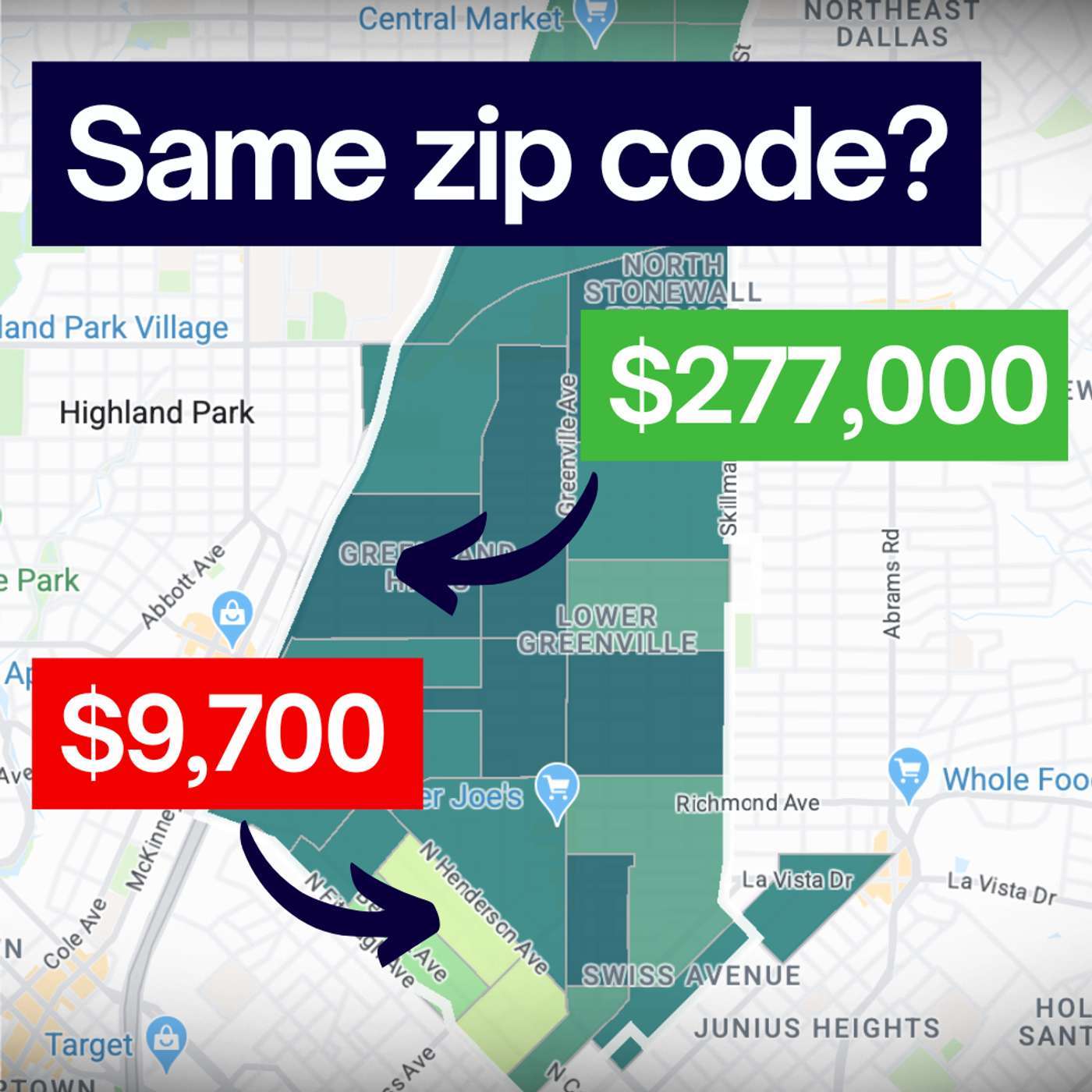
    The Hidden History (and Flaws) of the Zip Code

    In 1963, the US Postal Service introduced "Mr. Zip" to make mail delivery faster. They never intended for those five digits to determine your insurance premiums, your home value, or your health outcomes. In this short deep-dive, we explore how an arbitrar

Showing 1–20 of 20 episodes